For this years adventure I decided to post our log for the first few weeks. Hopefully this will portray our life on
Vagari reasonably. We also have lots of pictures.
A little background on this years cruise.
Rhea’s right knee has been giving her a problem so she decided to have another total knee replacement. She is schedule for December 5, 2006. We have to be home by the 1st of December and do
n’t expect her to be ready for sea until late March or early April.
We found out this week that our daughter is expecting her third child in April. We want to be there for that event.
All this means that we will restrict our cruise to the fall and spring and stay in the Sea of Cort
ez.
We left Sadd
lebrooke early this year, on Wednesday October 4th.
We put Vaga
ri in the water that Friday. Tuesday October 10 we left the dock to start this winters adventure. It was hot in San Carlos; we worked hard getting the boat ready for sea again but we spent the evenings catching up with cruisers from previous seasons so we enjoyed ourselves.
We also had our teeth cleaned and checked by a local dentist ($60 for both of us).
This link will take you to a Google satellite view of San Carlos. We were in the marina on the left. Vaga
ri spent the summer in the dry storage area just above the marina. You might enjoy zooming in and out or clicking on the map and drag
ing it around:
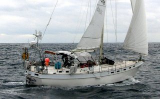
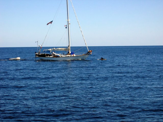
http://wikimapia.org/#y=27947554&x=-111073408&z=14&l=0&m=aWe started the 74 kt. mi. crossing to Santa Rosalia the next morning at 4 AM. We traveled with our good friends Steve and Linda on s/v (sailing vessel) Linda. They have a 42 foot sailboat build in 1957, which they have essentially rebuilt except for the fiberglass hull. She is a beautiful boat scaled down from an early 50’s Americas Cup boat.
Light winds on the crossing, we had both sails up most of the day which helped make this the fastest of the 4 times we have made this trip.
Highlights: warm but not hot until we got to the Baja s
ide; beautiful sunrise; almost hit a large fin whale (I was spotting on the front of the boat (bow) because we saw about 6 of them at the same time. Fin whales get up to 75 tons and 85 feet long vs. our 12 1/2 tons and 41 feet.) Rhea was driving; she experienced the same scary feeling that I do when driving in these situations. You realize that the whale is in control and you are just a spectator. Rhea backed off the throttle just as the whale did a shallow dive 30 feet in front of us.
To continue with the highlights; later, s/v Linda changed course 90 degrees and radioed us that they had spotted a “long line” fi
shing line just below the surface. We tried to find the end but couldn’t s
o s/v Linda crossed it with the engine in neutral. We did the same but got snagged. I had my diving knife in hand on the back of the boat when the pressure from the sails finally broke us free.
We had half a dozen strikes on the fishing line but no catches, that’s why t
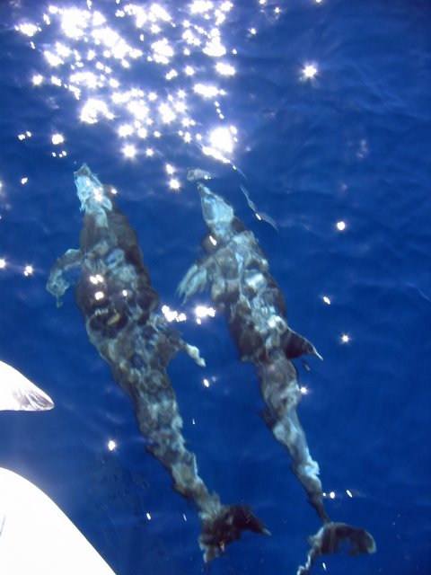
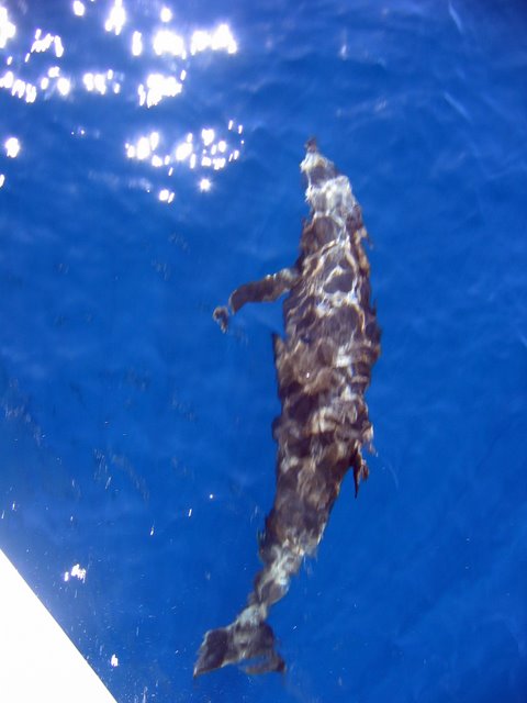
hey call it fishing not catching. Next, a school of dolphin visited and played in our bow wake. I’ll post some
pictures. Dolphins are kind of creepy. As they play in our bow wake they always turn sideways and look at me when I bend over the bow rail to take their picture. What is really weird is that they are always smiling in the pictures.
We arrived in Santa Rosalia at 4:30 PM, plenty of time to clean up before going out to dinner.
Link to Santa Rosalia Zoom out to see this unique town:
http://wikimapia.org/#y=27340064&x=-112264159&z=18&l=0&m=aAt the end of the 19th century this
was a large mining town owned by a French firm. We had breakfast in a 120-year-old hotel followed by a visit to the mining company office of the same age. The first floor of the office is a museum. This was our second visit and we would go again. Dinner the next night was at the hot dog stand. I’ve written ab
out
it before. They open at 7 PM and are open most of the night. Their bacon wrapped hotdogs have witho
ut a doubt the most cholesterol that can be put in bun.
The small harbor is home to fishing of about 75 to 100 twenty-foot open fishing boats (called panga’s). They fi
sh for giant squid; they get up to 100 lbs. We saw some being caught as we came into the harbor.
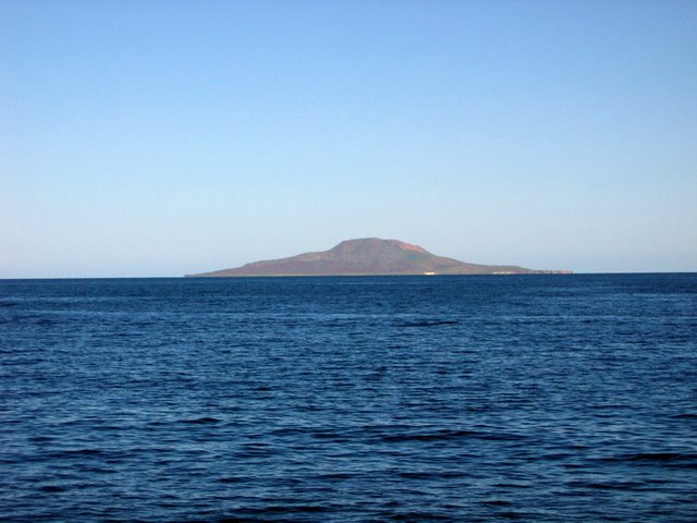
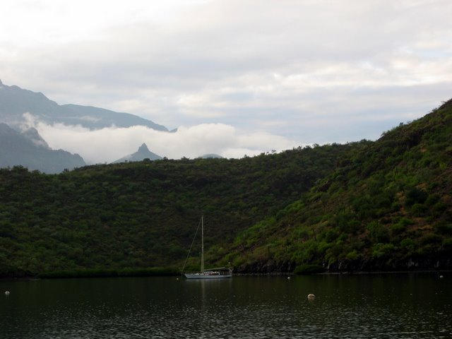
Friday the 13th we headed south
to the Island of San Marcos. We sailed most of the way. If you live on the west coast this island may surround you. Your drywall walls, which are made from gypsum, almost certainly came from San Marcos. When sailing nearby we usually see a cloud of gypsum dust that comes from the ship loading operation.
We anchored between two reefs off the south end of the island near the company town. Steve and I walked into town. The pictures tell the story. As we walked out of town a group of kids followed us skipping and jabbering. Americans seldom stop here partly because it’s a challenging a
nchorage and partly because it’s a remote island.
So I think the kids were just gawking at us. Look at the picture of the main church; it’s made from solid gy
psum! The other one may also be gypsum. I didn’t climb the steps.
If you use the Google map link you can see the open pit mining at south end of the island. Zoom out to see the whole island. Santa Rosalia is just North of the Island.
http://wikimapia.org/#y=27190518&x=-112066040&z=13&l=0&m=aWe sailed most of the way to our next anchorage also. This year we are making a real effort to sail more and motor less. That means shorter hops, which gets us into new anchorages. It also means being satisfied with speeds as low at 2 or 3 mph. After almost three years of retirement I’m learning how to live at
3 mph and really enjoy it. Plus the sailing is as much fun as ever.
We saw one Fin whale dive but he was at least a mile away. As we neared our anchorage the wind picked up to 25 kts with higher gusts. We had
a wild ride and lots of fun. We tucked into a safe anchorage. The next morning I went shelling with the crew from s/v Linda. I think I can make wind chimes from shells and driftwood. Kids you may soon have something else to hang out when your parents visit.
This Google map showes Isla San Marcos down to
Concep
cion Bay.
http://wikimapia.org/s/#y=26907375&x=-111957550&z=10&l=0&m=aThen we sailed to Conception Bay. Started slow again then blew big time so we had another wild ride. This sailing is more fun than I remember.
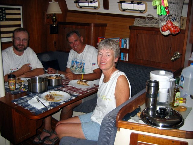
I have been asked what do you do all day. Here is an example. I had hot cereal for breakfast. It takes an hour or so to get out of the anchorage and set the sails and compute the course for the day. Then Rhea gave me a haircut while underway. Then a shower with our solar heated water. Checking our course, trimming sails, fishing and hopefully catching then taking the sails down and getting ready to anchor is next. Oh, we spend time just enjoying the scenery and nature. The water is still in the 80’s and the air is warm so we have a lot to enjoy. A swim after we are anchored to check the anchor is never a bad idea. We had dinner with our good friends Linda and Steve. Then back to Vagari and to bed shortly after
the sun goes down.
Monday October 16 was a stellar day. We went claming. I got enough for dinner
for both of us. We moved to a beautiful cove, Santa Barbara, and some more claming. This cove has been “ove
r utilized” as far as clams go but
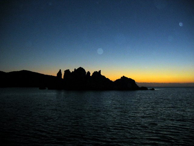
we saw lots of pin scallops so maybe tomorrow we will go after scallops. Dinner was a clam feast with fresh fruit salad and cookies for dessert. I know I have said it several time that this was the prettiest anchorage I have seen but you will add this to the top of the list.
Tuesday 10/17/06
Sailed just over 20 miles. It started with little wind but picked up as we went up the mouth of Conception Bay. We sailed “wing and wing” – the front sail was out on one
side and the main sail was out on the other side. We could do this because the wind was coming from right behind us. We had another great ride.
We anchored in a very open cove. The waves came from a different direction than the wind so the waves hit us right on the side, which made us rock and roll all night.
Wednesday we sailed south about 25 miles to San Juanico Bay. We caught two small Dorado bu
t let them go. Our buddy boat ca
ught a large Dorado 10 miles from San Juanico. We had
a FRESH fish dinner on boa
rd Vagari. We motored sailed except for the
last 10 miles which we just used the sails. We spent the next day in San Juanico exploring a fresh water lagoon, sw
imming and hanging around the boat.
San Juanico Bay:
http://wikimapia.org/#y=26367571&x=-111428833&z=13&l=0&m=aFriday 10/20/06
Sailed a few hours down to Isla Coronados. Steve and I hiked to the t
op of
the volcano that formed this little island. The Saddlebrooke Hiking club would rate this
as a B+ hike. Only 1500 elevation gain to top but some up and down. Well over a mile walking on uneven sharp rocks that the volcano must have blown out. The last mile is very steep with small pebbles. You slide back almost as much as you go up. Neither of us carried enough water. I should have known better.
Isla Corodados:
http://wikimapia.org/#y=26119531&x=-111276827&z=14&l=0&m=aYou will like the pictures.
Saturday we motored a few miles to Loreto and anchored just off the town. We had lunch and dinner in town and got some groce
ries. The forecast was for no wind so we spent the night.
Sunday 10/22/06
We motored 11 miles to Isla Carmen’s Bahia Marquer. Steve and I dove for Cholete Cams.
Steve got 50 and I got 15, but I was getting p
retty good at the end. That evening we had a clam bake/pot luck dinner. s/v Canace joined us and we invited a couple of kayakers camping on the beach. Doesn’t get any better. At sunset the “no s
ee ums” feasted on Rhea so we high tailed
it
the b
oat then we moved Vagari further out to get clear of the bugs.
Monday morning we motored 8 miles to Puerto Escondido. Hurricane Paul has us concerned
. If you can get the Google Maps link working you can see that this is a perfect hurricane hiding place. Started raining in the late afternoon with moderate wind. We are secured to a mooring ball so it’s no problem.
Puerto Escondido, the perf
ect natural harbor:
http://wikimapia.org/#y=25820290&x=-111310043&z=13&l=0&m=aTuesday 10/24/06
Rain and some wind last night. I washed Vagari with soap and salt water then let the rain r
inse her. I took on 30 gallons on fresh water. It’s a story in itself how we get the water but the
12 volt pump setup I made this summer to transfer the water from the dinghy to our tanks worked as planned.
From Monday afternoon to sunset Tuesday we had light and some heavy rain, all from Hurricane Paul. We left the boat late Tuesday afternoon to get our laundry. It wasn’t ready so we had dinner at the nearby trailer p
ark. It poured during dinner but slowed to a drizzle as we walked the mile to the dinghy dock. We got a ride most of the way from a fellow cruiser but it rained on the dinghy ride back to Vagari. Cruising is an adventure.
Wednesday 10/25
/06
>
I got another load of water in the morning. I took some silicone tape and fixed the leaky hose. A moderate surf was running outside the harbor, from hurricane Paul I assume. I finished a book I started yesterday. That says it all about the type of day we had.
Thursday 10/26/06
A strong north wind (30 kts) is forecast for Friday so we left Escondido at daw
n to go 24 miles to a popular anchorage (Agua Verde) that is protected from the winter “northerl
ies”. It’s a small community that raises goats an
d has less than
a dozen small fishing boats (pangas). We arrived at noon and tucked in tight to an east-we
st beach so we are ready for the big blow. Had three fish hit my fishing lure. Landed one but it as a skipjack tuna and the Admiral does NOT grant skipjack permiss
ion to board. We went swimming after the s/v
Linda’s crew floated over we jumped in and floated around wit
h them on floats Joe gave us.
Friday 10/27/06
The wind blew all night. After breakfast our anchor started to drag. We were dragging toward another cruiser that wasn’t dragging. We raised the anchor, moved away and re-anchor
ed. Done this many times before but not in these winds. Rhea drove Vagari like a pro in the strong winds.
After lunch we walk
ed a couple of miles into town. The surf was too big for us to take the dinghy. Agua Verde is 13 miles from a paved road, its only access to the
rest of the world. It has a small school, two churches and a very small store in somebody’s house.
Two years ago Agua Verde had a dozen or
so fishing pangas. A man came by in a pan
ga selling shell jewelry. I ask him a
bout the fishing he said th
e fish are “very small, very very small”. Perhaps they have fished Agua Verde out. How can they compete
with the long lines and factory sh
ips?Agua Verde:
http://wikimapia.org/#y=25521375&x=-111068001&z=15&l=0&m=aAs the sunsets the northerly is dying. We will leave at first light for a long run south.
Saturday 10/28/06
We left Agua Verde hoping to ride the dying northerly south. We could hear the
surf pounding the beach outside the anchorage but the forecast for the next day was light to moderate winds from the southeast, just where we were heading. It was a wild ride. Vagari was covered with spray after two miles. We made the fastest pass
age ever, 55 kt. miles averaging 6.6kts/hr. We surfed down some large waves at 9 kts. I hand steered because we didn’t have the right sail combination up
. Changing sails in those wind
s and waves was not something we wanted to do.
We anchored in beautiful Isla San Francisco, went swimming and s/v Linda over to eat the Dorado th
ey caught a couple of hours before.
Isla San Francisco:
http://wikimapia.org/#y=24828806&x=-110572586&z=14&l=0&m=a
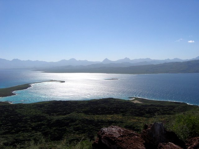
This was the clearest water I have seen in Mexico. Vagari looked like she was floating in air above a sand beach with our an
chor buried in the sand.
Sunday
The insects came out a sunset and again at dawn so three boats decided to head south to Isla Partida. Reports on the radio said insects were not a problem there.
Part
ida is only 25 miles from our turnaround point of La Paz. Beautiful s
ail, light winds so we had the motor on also. We think we
saw a bale of what must have been cotton in the water about 5 miles into the trip. One rule we learned very early is, “don’t see – don’t tell” so we didn’t see that bale of cotton. The wind pick
ed up in the mid
dle of t
he voyage so c
ould sail for a while.
Monday we spent the morning hiking in Partida Island but the bugs forced us back to the boat after and hour or so. We then
motor sailed down to an anchorage just 7 miles from La Paz.
Isla San Francisco to La Paz with the Isla Partida anchorage in the center
:
http://wikimapia.org/#y=24494647&x=-110445557&z=10&l=0&m=aTuesday we arrived in La Paz, our turn around point. This is really a charming city and we will be here for th
e Day of the Dead celebration.
The Day of the Dead holiday has no equal in our culture. It is a celebration and a family day spent at the family cemetery plot. This link explains this custom better than I can.
http://www.mexconnect.com/mex_/muertos.htmlWe are leaving La Paz Saturday 11/4/06 to start the trip back to San Carlos.